Muhayil Downtown & Wadi Development
Project overview
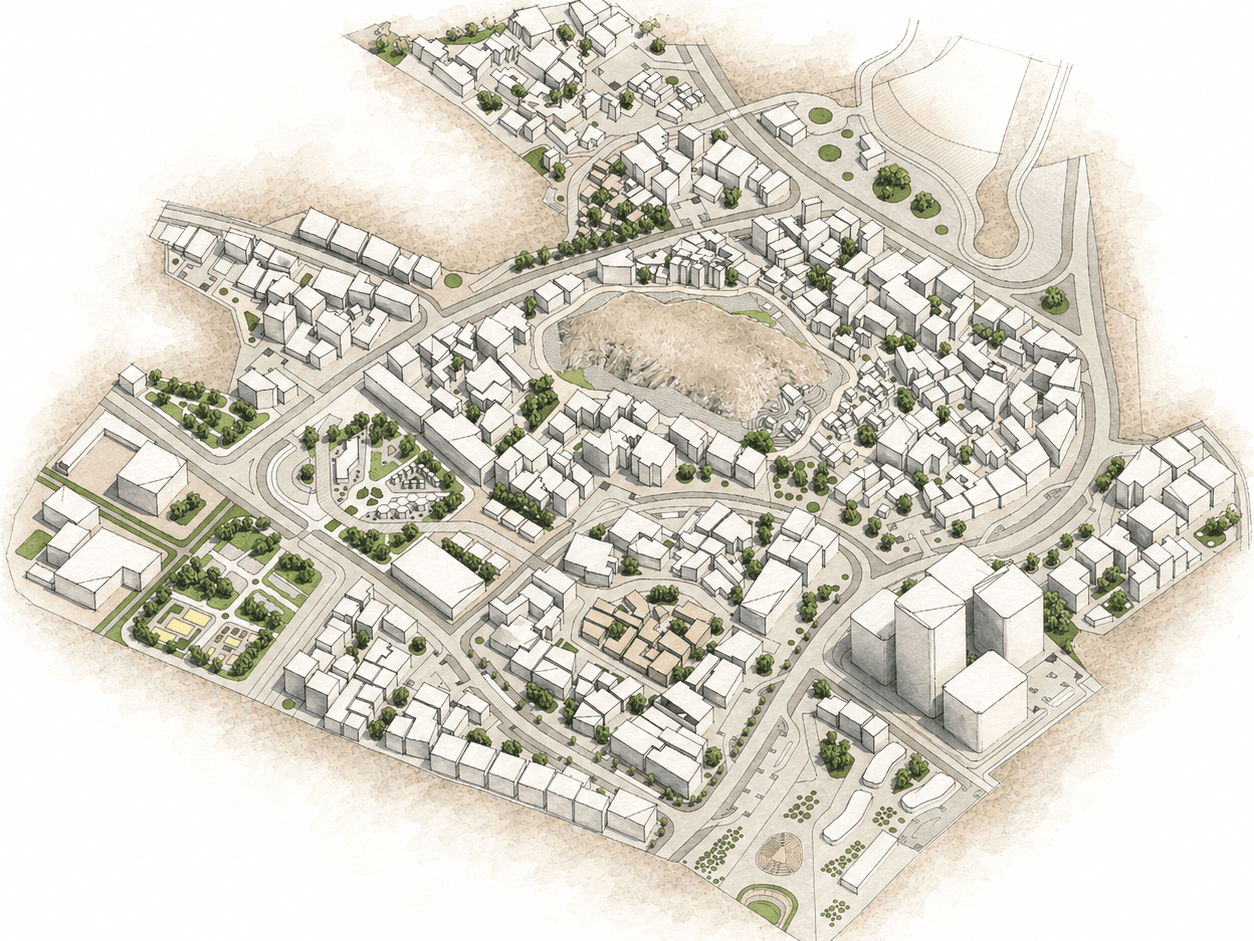
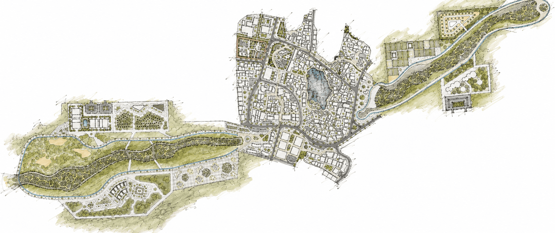
Muhayil Downtown & Wadi Development is an urban design proposal for central Muhayil in the Aseer Region.
The project connects the city centre with both banks of the wadi through a network of pedestrian routes, public spaces, green corridors and mixed community activities. It builds on the area’s existing markets, heritage villages and varied urban fabric while improving accessibility, public life and the relationship between the city and its natural landscape.
Project Information
Location | Muhayil, Asir Region, Saudi Arabia |
Project Type | Urban regeneration and downtown development |
Studio | Urban Design Studio VII |
Academic work | Individual academic project |
Project Scope | Urban analysis, masterplanning, mobility, public realm, landscape and urban design guidelines |
Role | Urban research, concept development, masterplanning, mobility strategy, public realm design and visualization |
Site Analysis & Existing Conditions
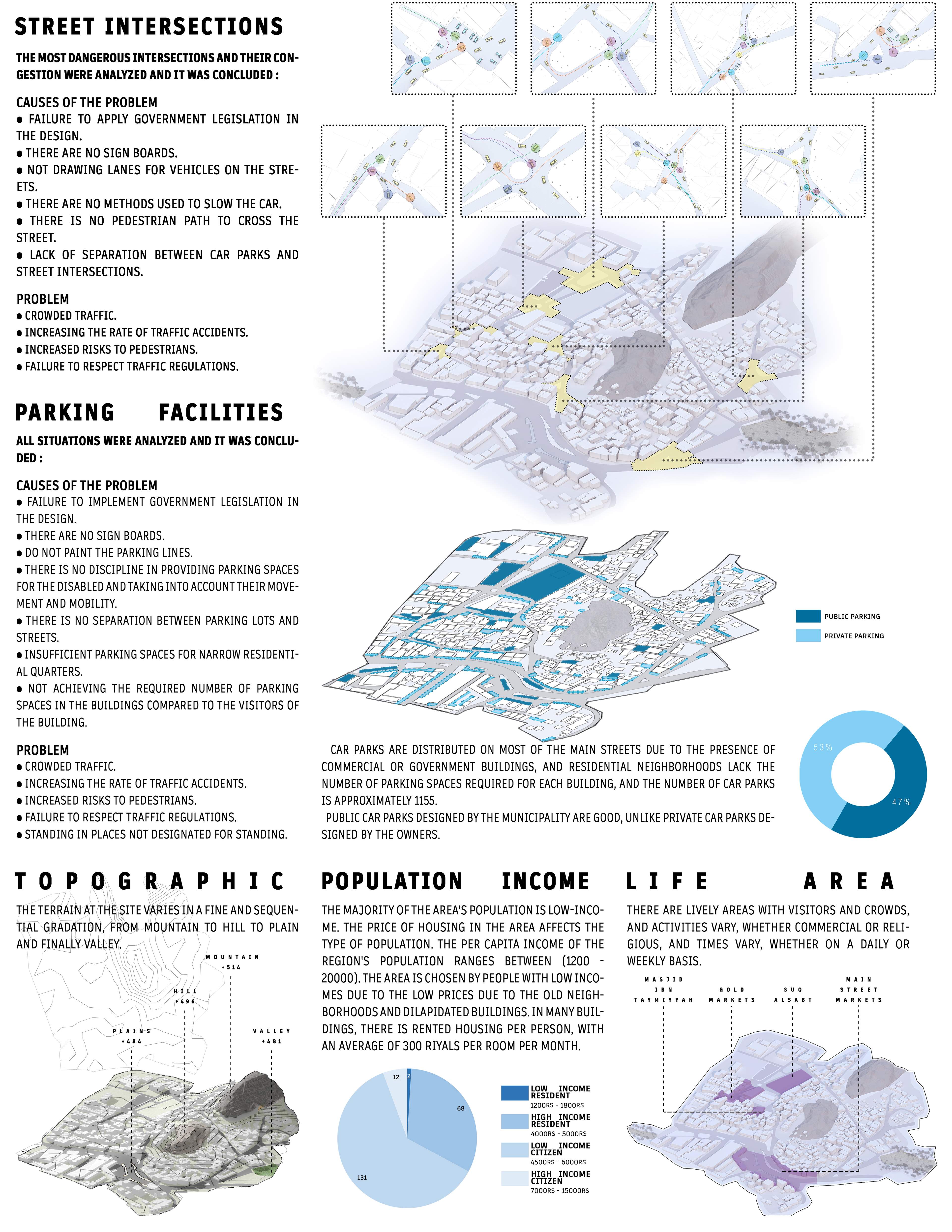
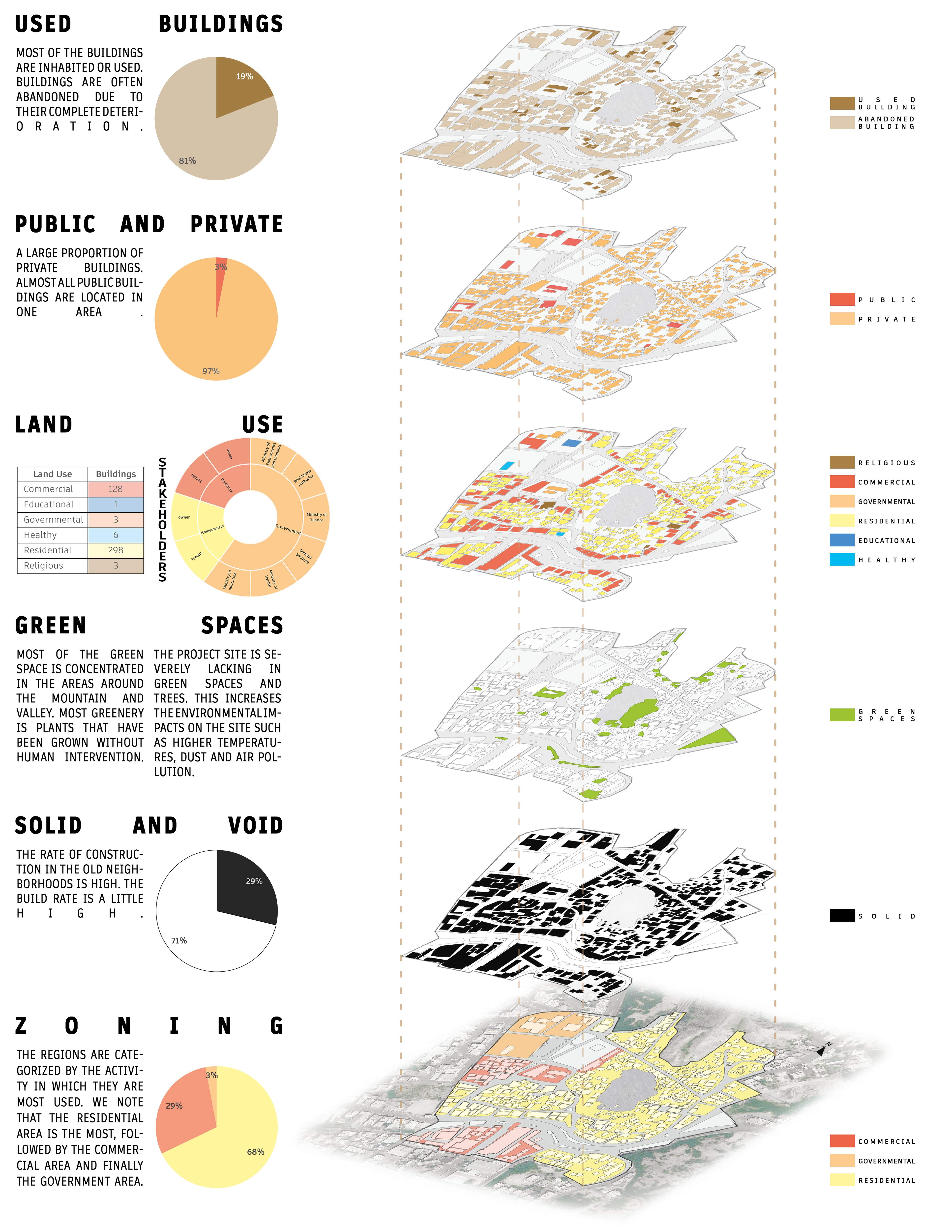
The site analysis examines central Muhayil’s existing urban fabric, including land use, building occupancy, public and private distribution, green spaces, mobility, parking, topography and activity patterns.
The findings identify fragmented pedestrian movement, traffic conflicts, limited green infrastructure and uneven building conditions, forming the basis for the proposed regeneration strategy.
Design Concept
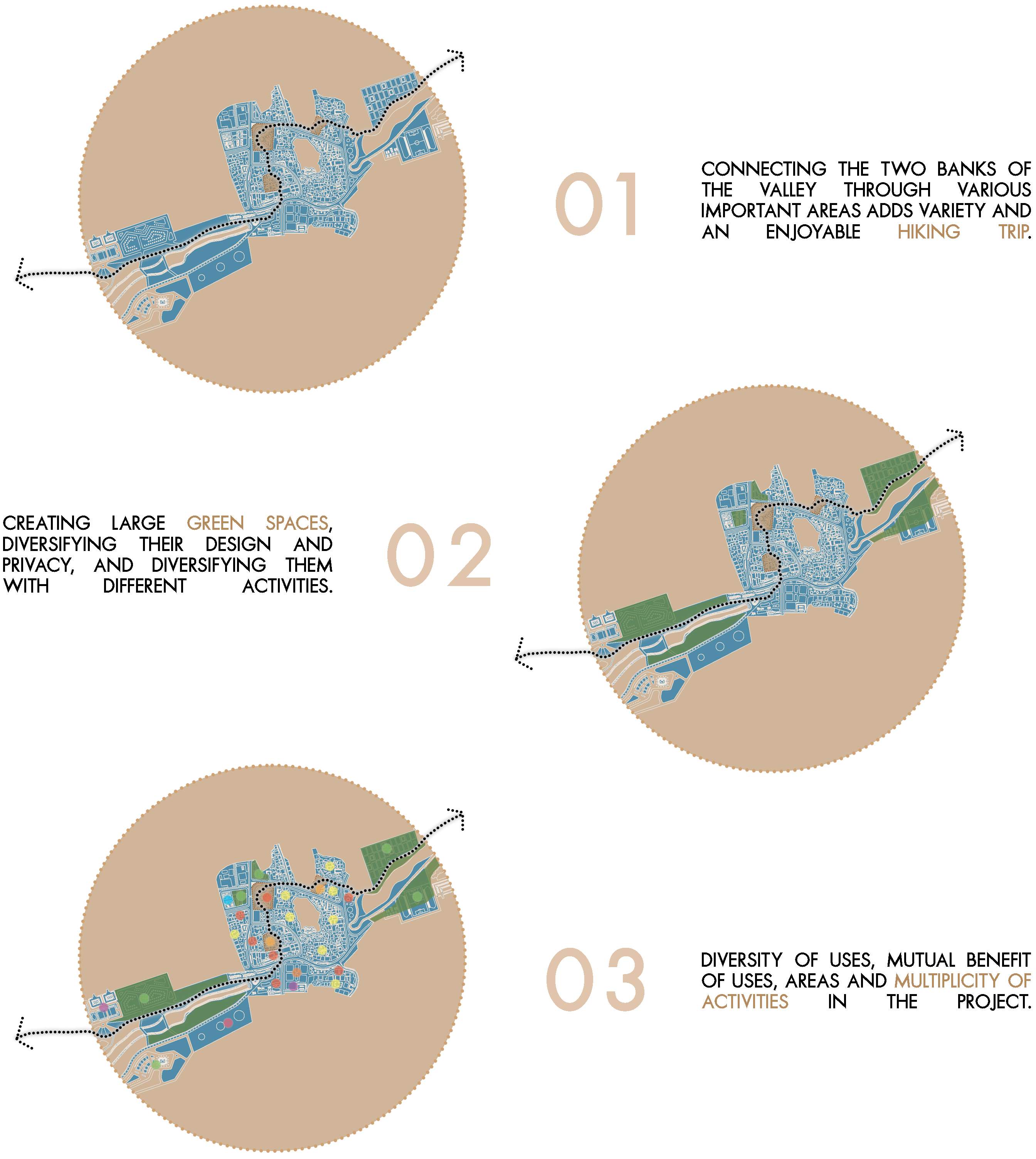
The concept connects Muhayil’s downtown with both banks of the wadi through a continuous network of pedestrian routes, public spaces and activity nodes.
The proposal expands the green network, strengthens connections between existing destinations and introduces a wider mix of cultural, commercial and community uses across the urban area.
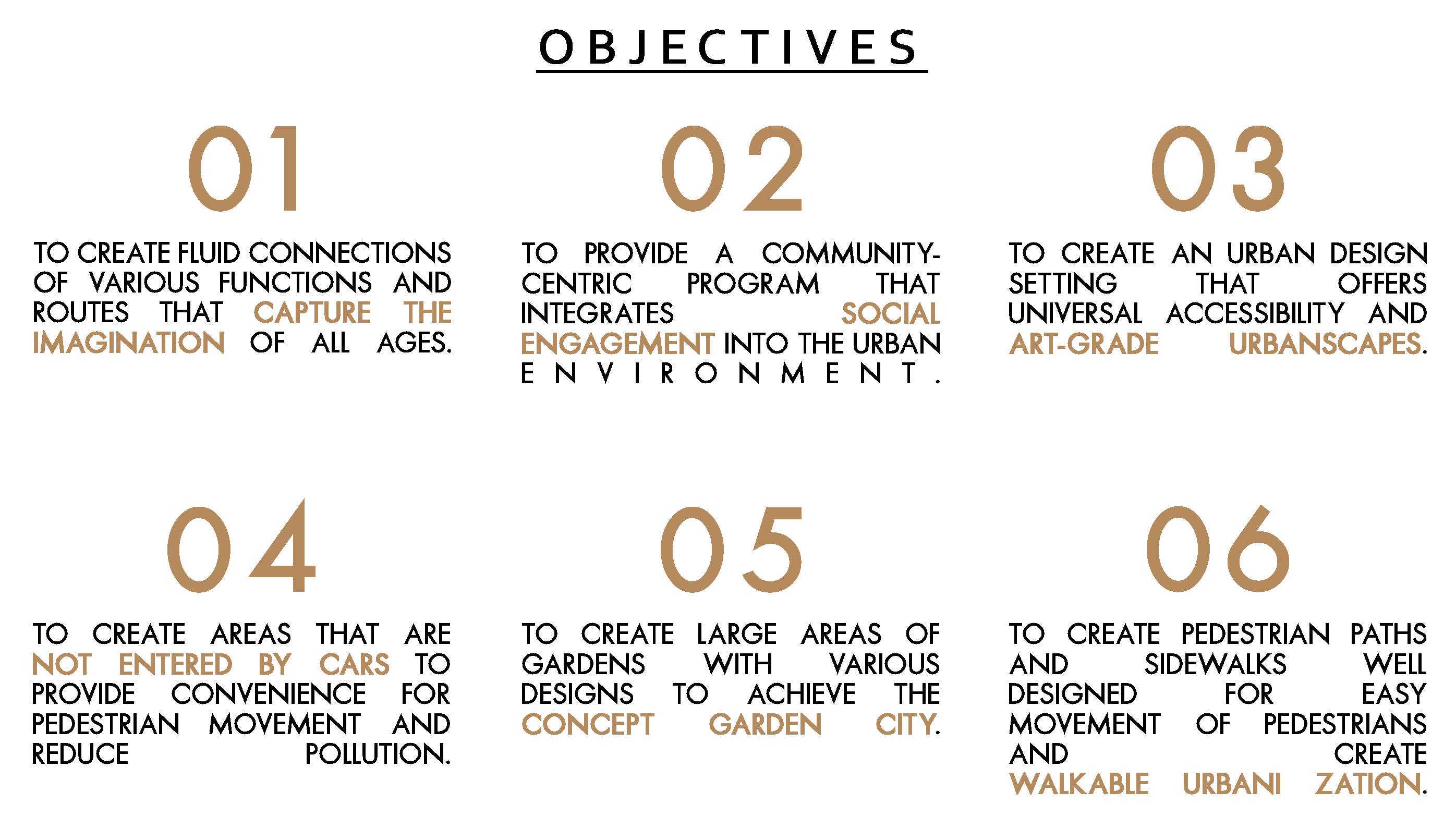
Project Objectives
Urban Transformation Strategy
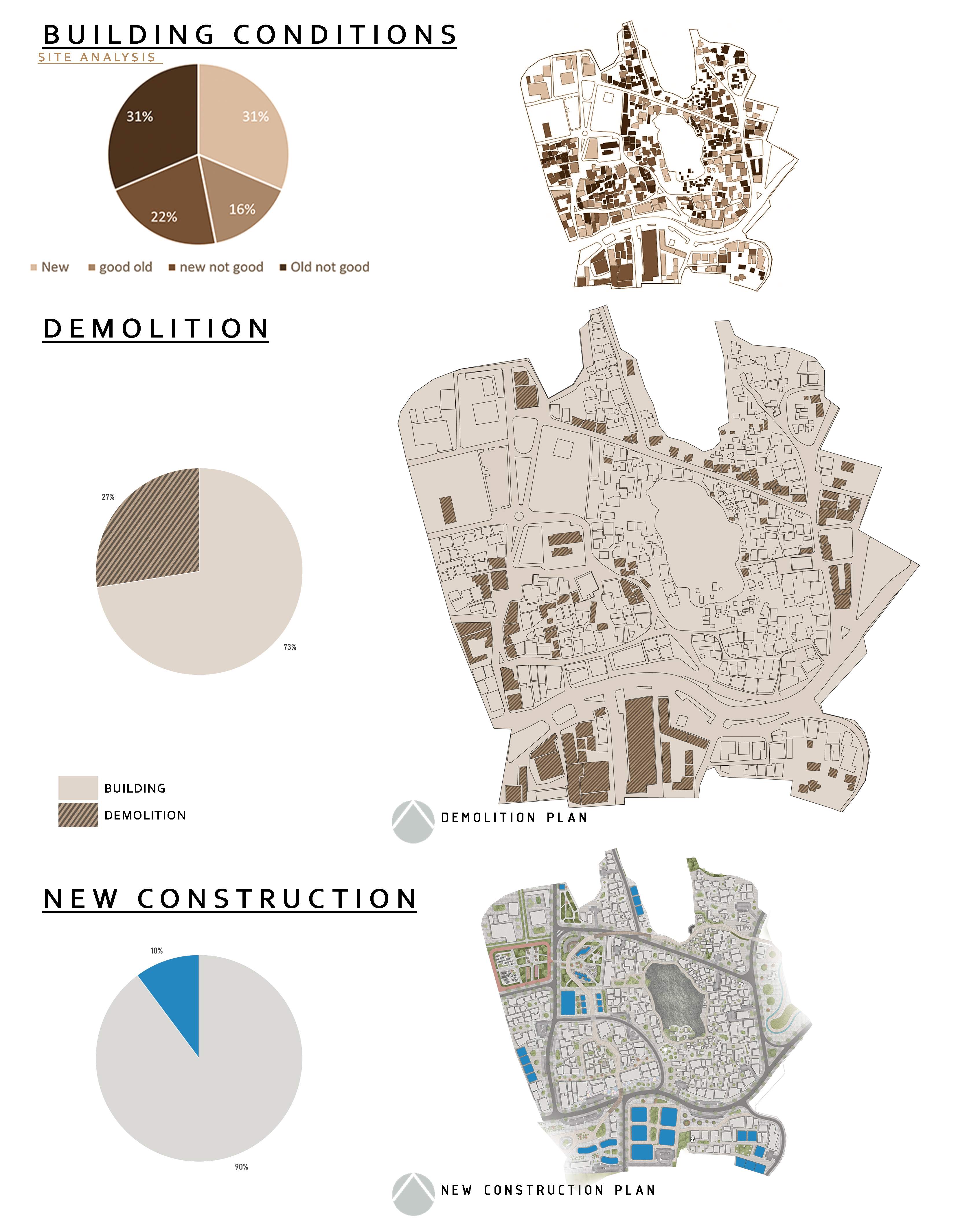
The strategy evaluates existing building conditions to identify which structures should be retained, removed or replaced.
Selective demolition and targeted new construction reorganise the urban fabric while creating space for improved circulation, public amenities and new mixed-use development.
Urban Form & Green Network
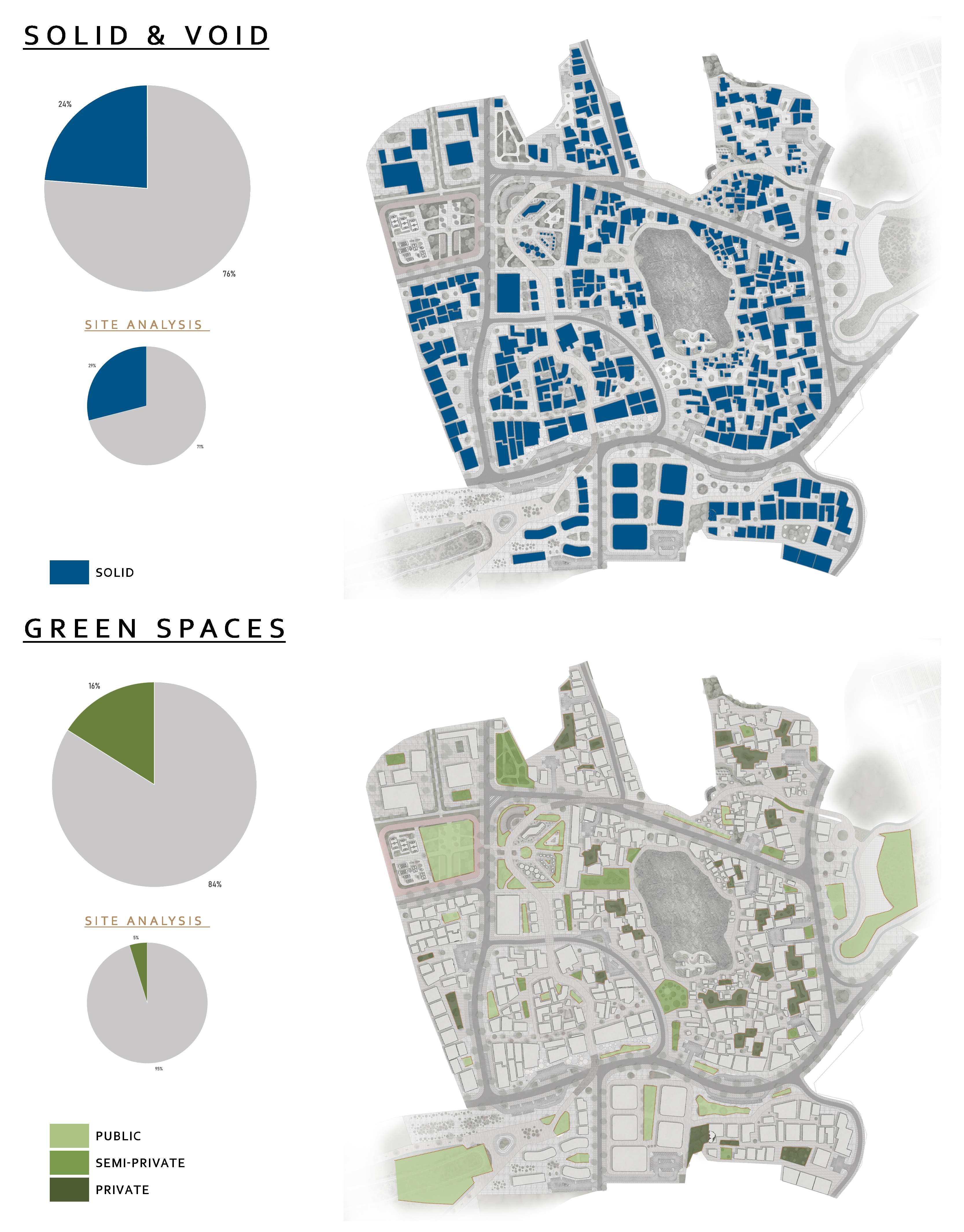
The proposed urban structure balances built mass with open space while expanding the green network across central Muhayil.
Compared with the existing condition, the proposal reduces built density and increases public, semi-private and private green spaces, creating a more connected relationship between buildings, streets and the wider landscape.
Masterplan
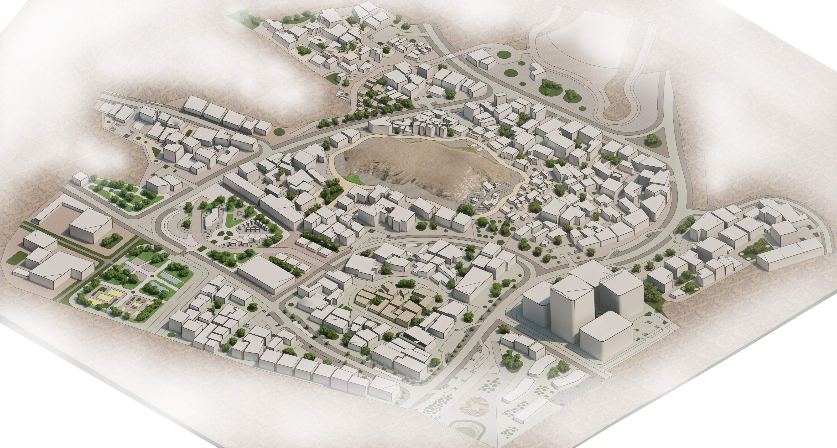
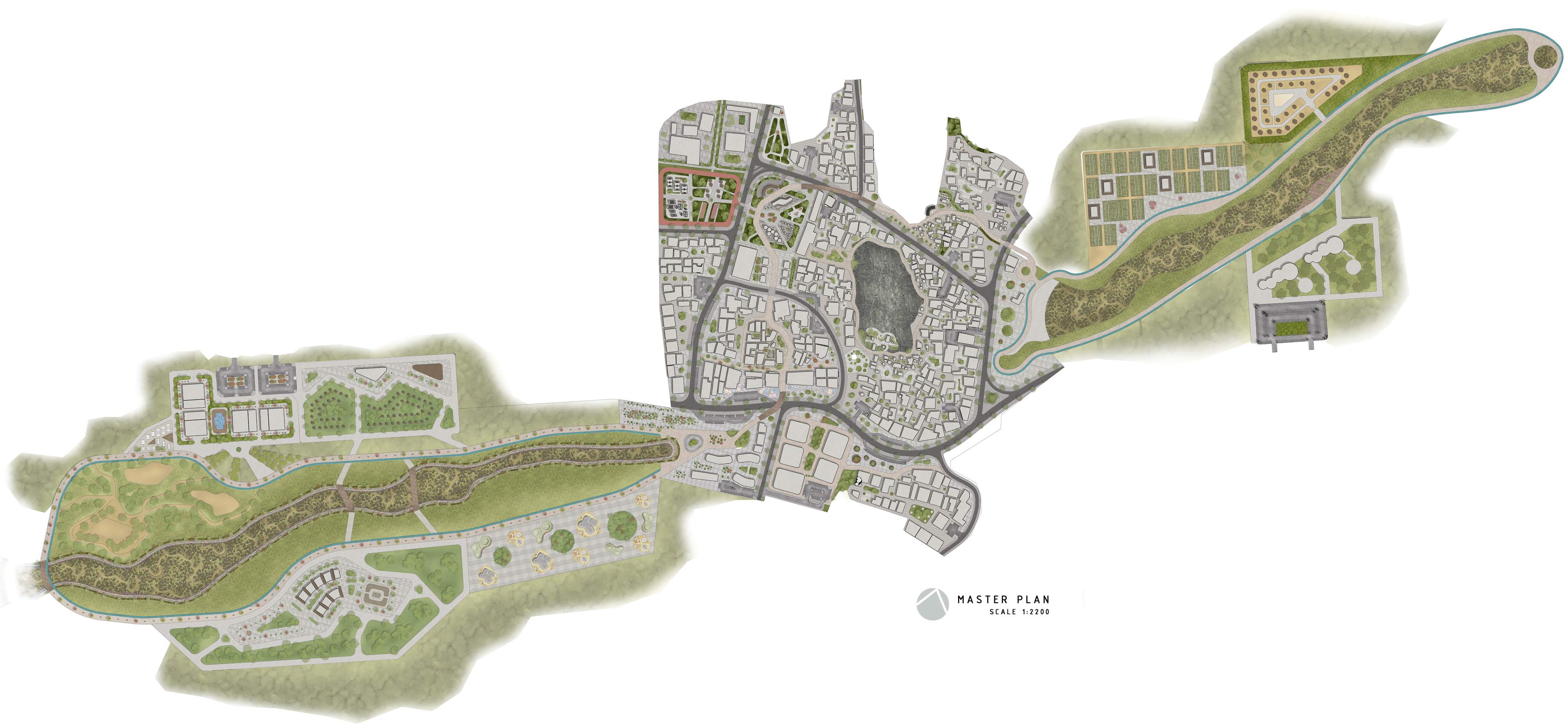
The masterplan reorganises central Muhayil around the wadi, connecting existing destinations with new public spaces, pedestrian routes and mixed-use activity areas.
The proposal distributes cultural, commercial, recreational and community functions across both banks while maintaining clear movement between the downtown, Souq Al-Sabt and the surrounding neighbourhoods.
Activity Distribution
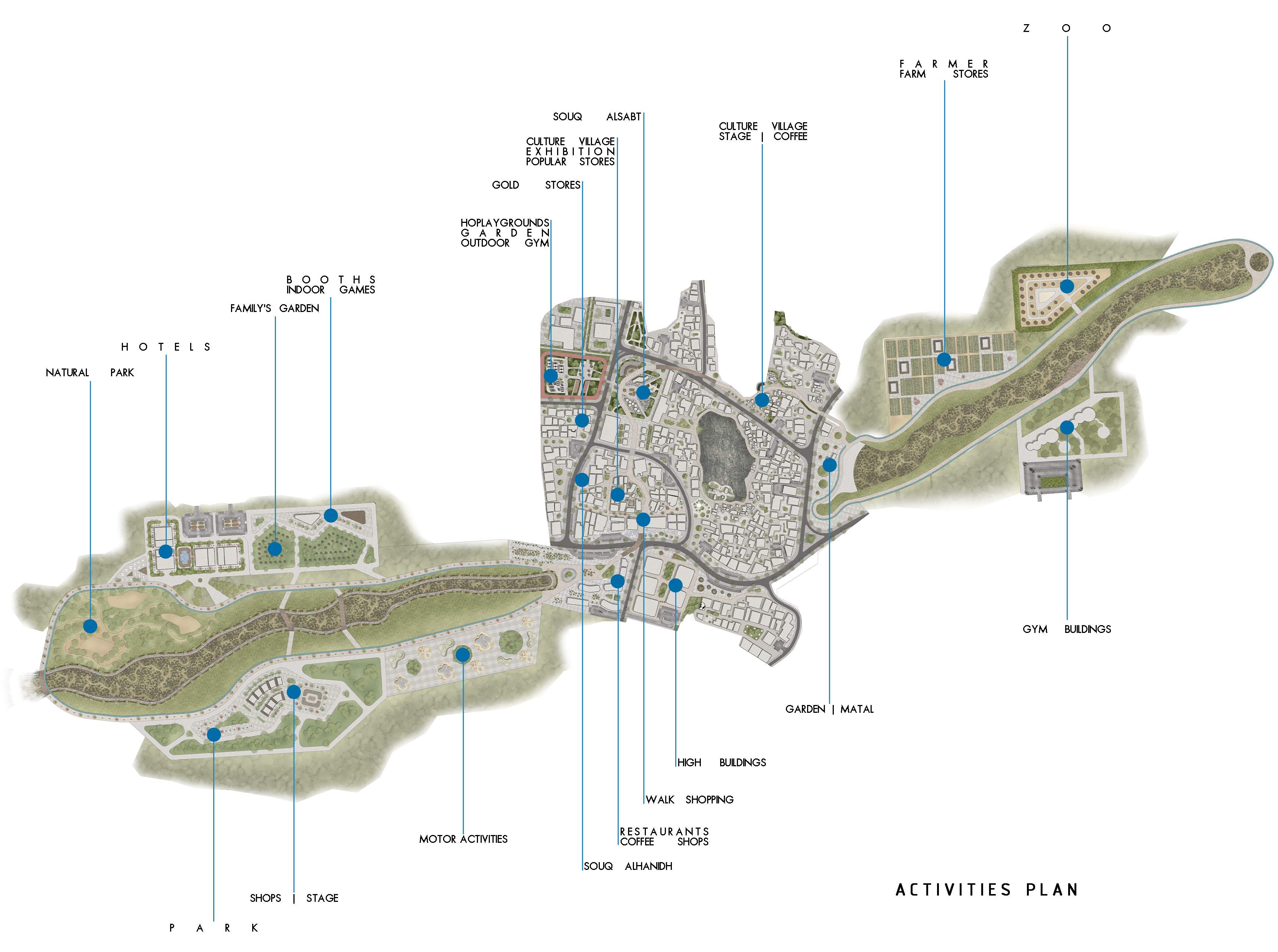
Proposed Land Use
The proposed land-use framework distributes residential, commercial, cultural, hospitality, governmental and public uses across central Muhayil.
The strategy reinforces existing urban destinations while introducing complementary activities along the downtown and wadi corridors.
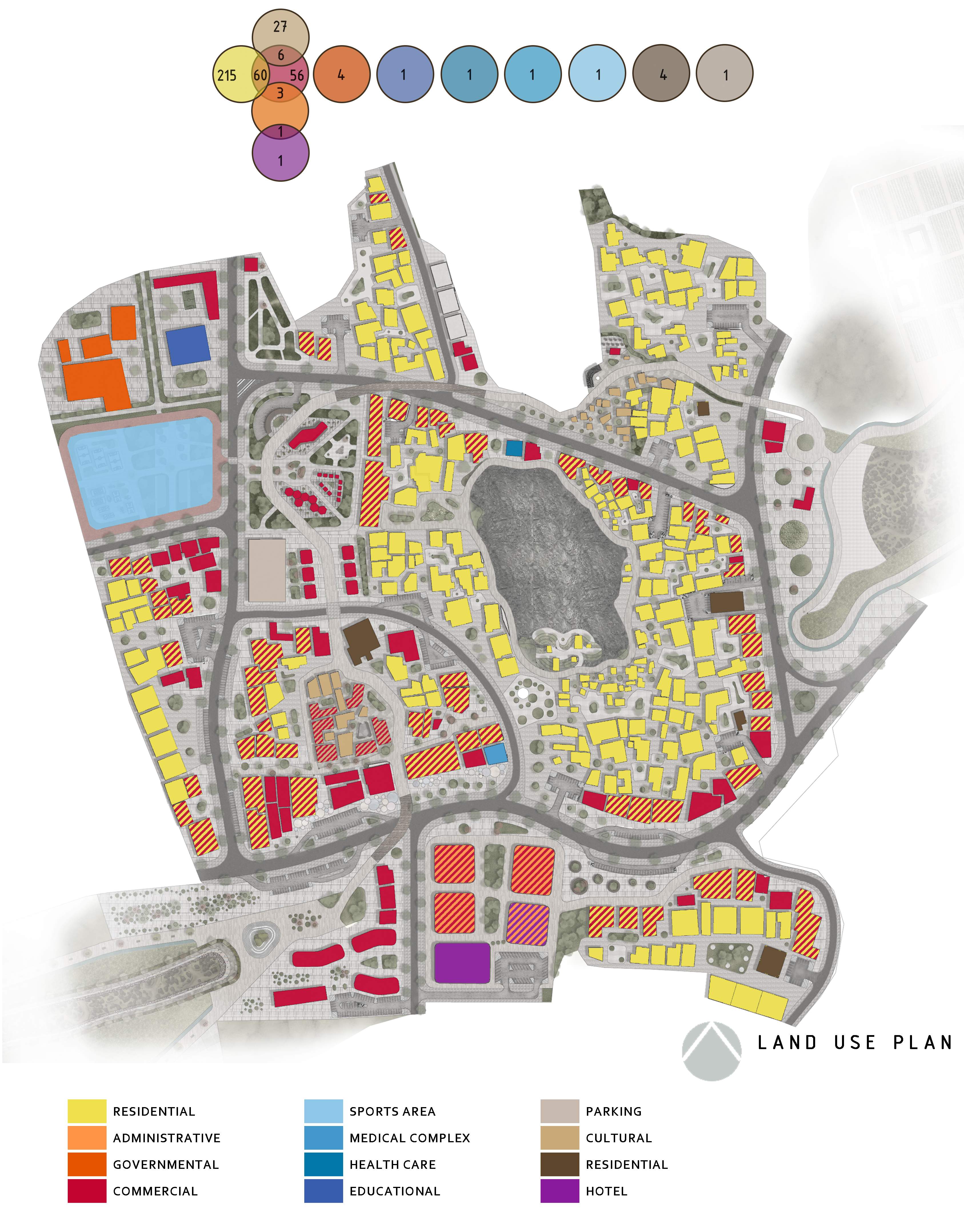
Proposed Building Heights
The proposed height strategy maintains a predominantly low-rise urban character while allowing greater height along selected main streets and development nodes.
This distribution responds to the existing urban fabric, preserves the human scale of central Muhayil and supports a gradual transition between the downtown, surrounding neighbourhoods and the wadi.
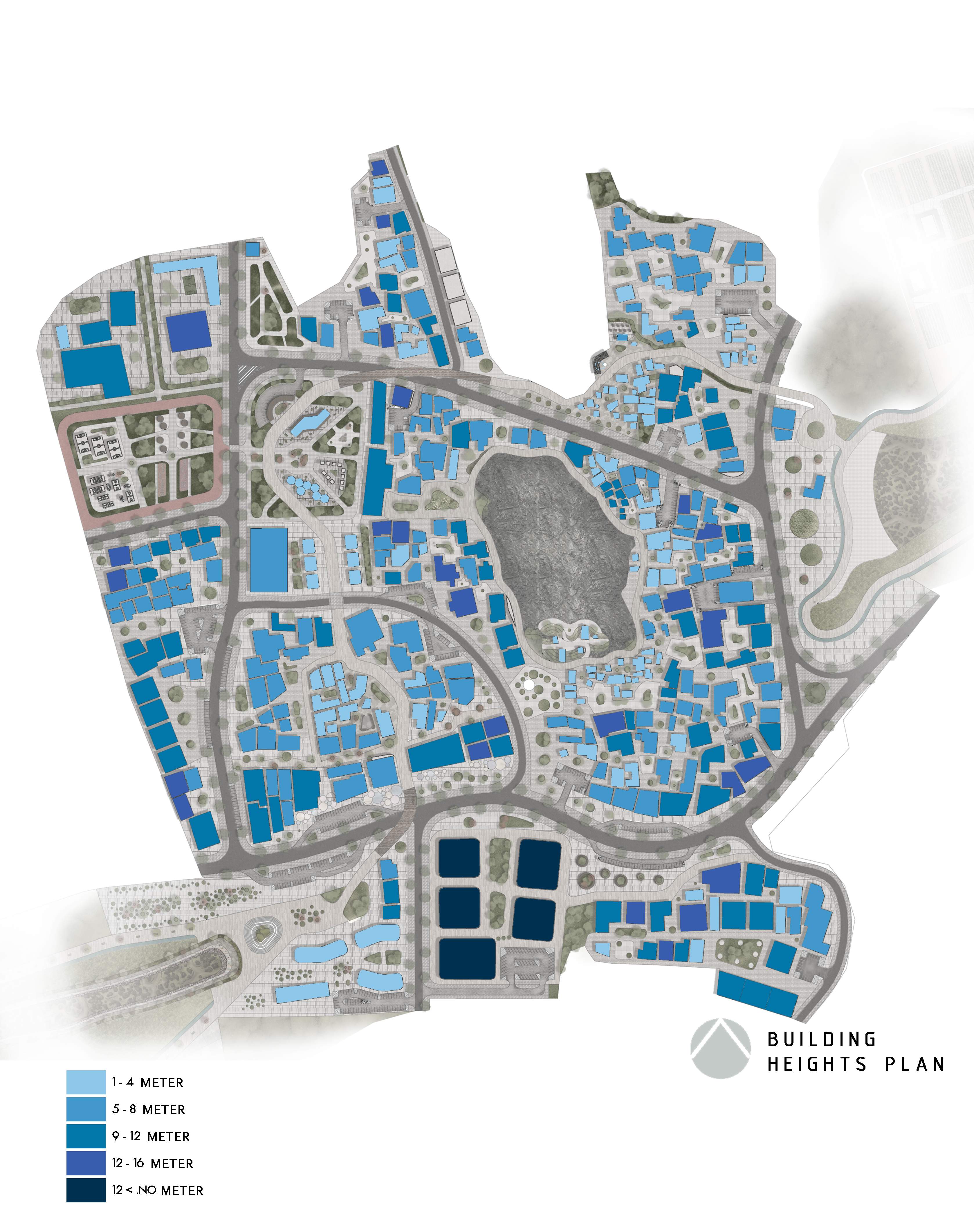
Proposed Pedestrian Network
The pedestrian strategy connects the two sides of the valley and links the main urban destinations through a continuous network of walkways.
Distinct routes are provided for local residents and visitors, including neighbourhood paths, connections around the mountain and a multi-activity trail extending across the project area.
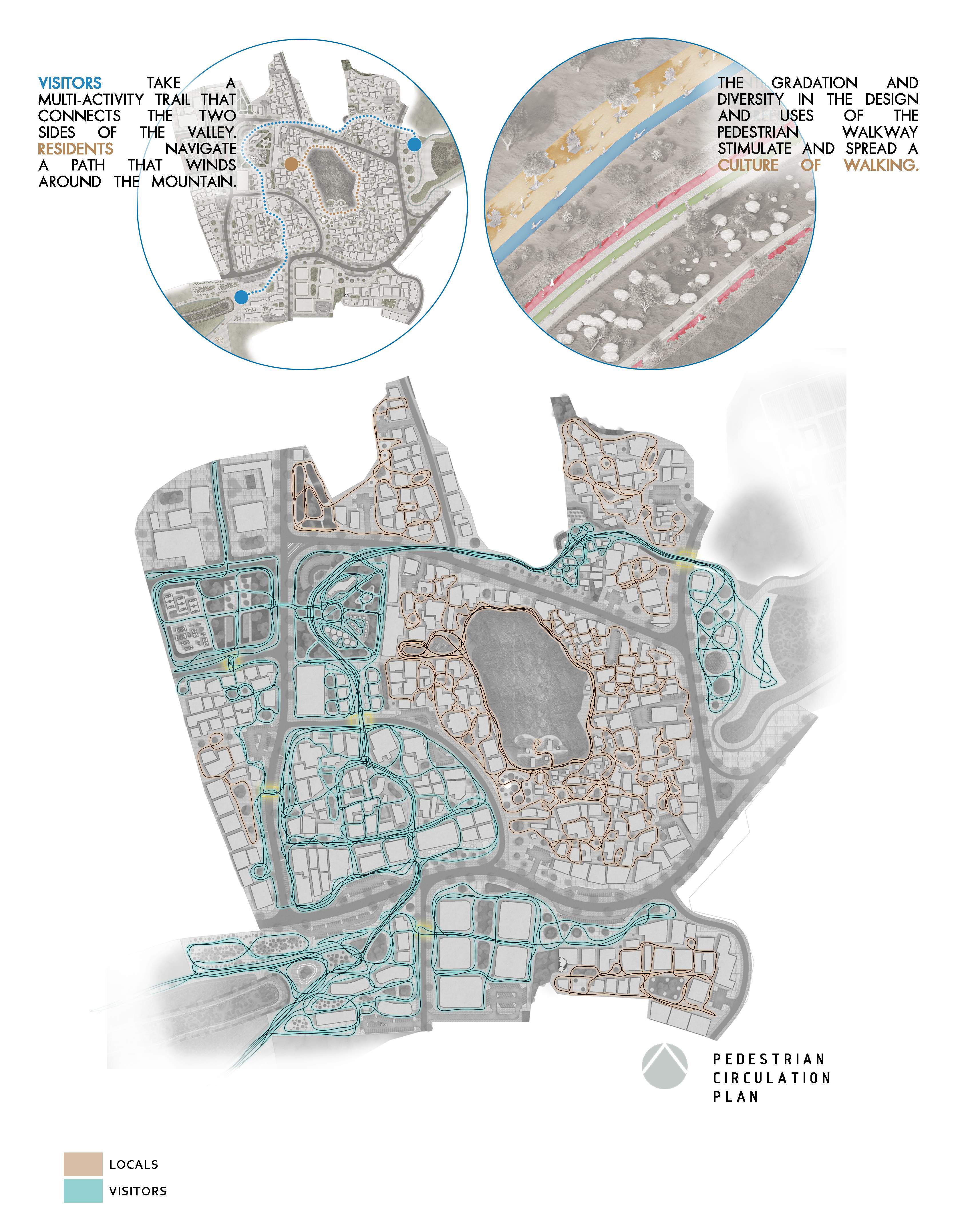
Proposed Vehicular Network
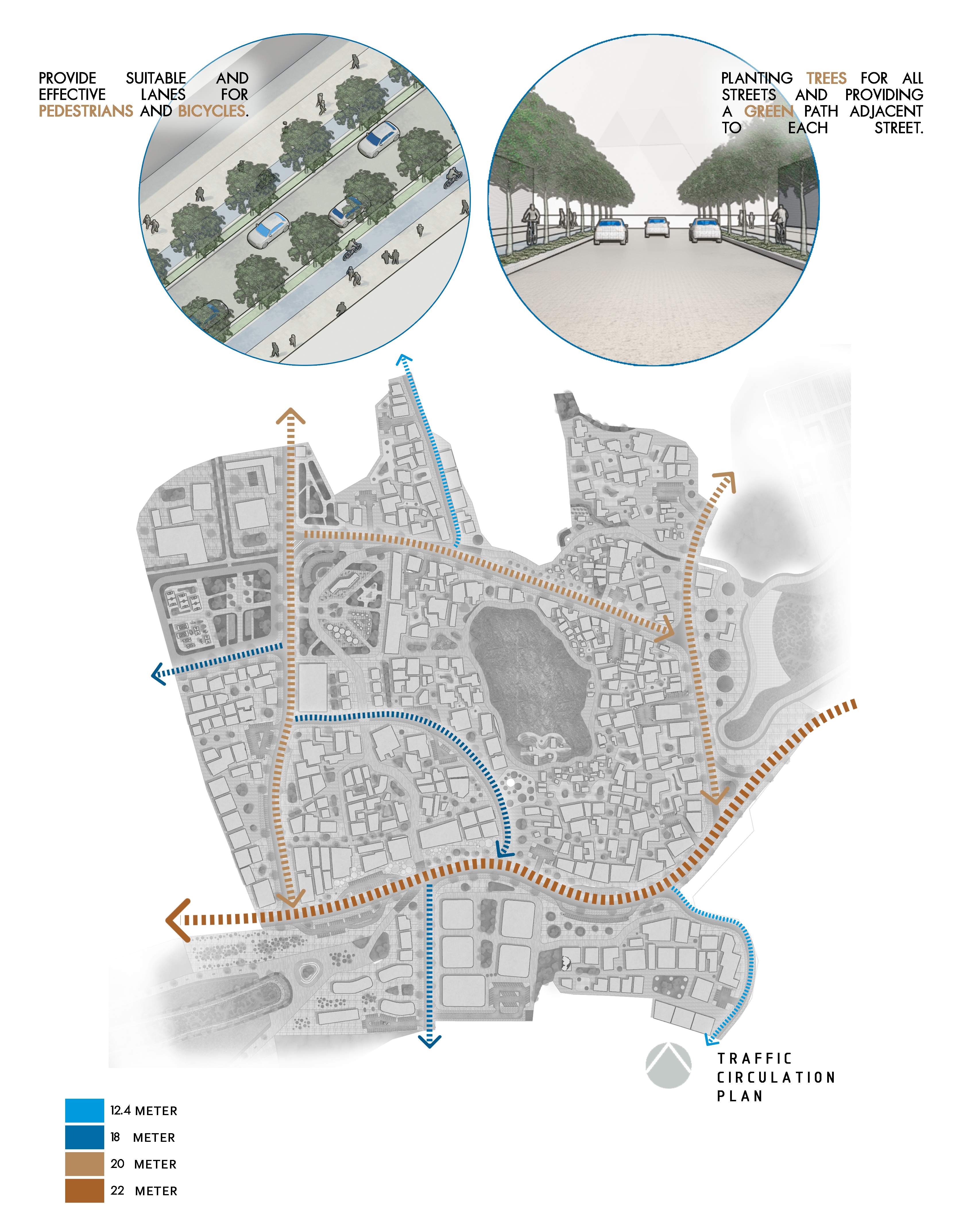
The proposed vehicular network organises movement through a clear hierarchy of primary and secondary streets connecting the downtown, surrounding neighbourhoods and major activity areas.
The strategy improves accessibility across the project while coordinating vehicle movement with pedestrian routes, parking areas and the proposed public-space network.
Street & Wadi Sections
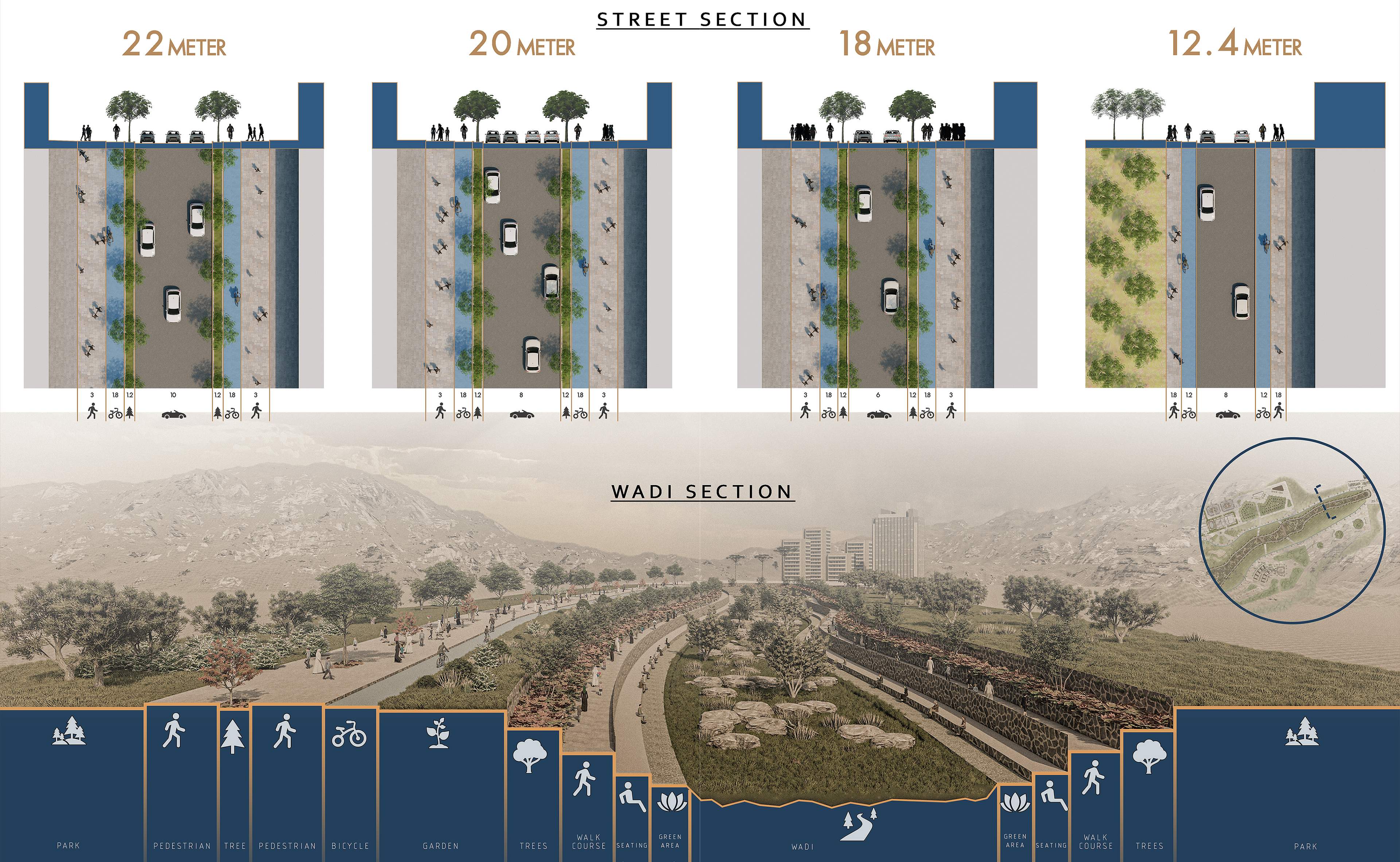
The section studies define the relationship between movement, landscape and public space across the project.
Four street typologies organise vehicular lanes, pedestrian sidewalks, cycle paths and planting strips within 22 m, 20 m, 18 m and 12.4 m rights-of-way. The wadi section transforms the valley into a landscaped public corridor integrating parks, pedestrian routes, cycling, seating areas, gardens and the natural watercourse.
Urban Design Guidelines & Architectural Character
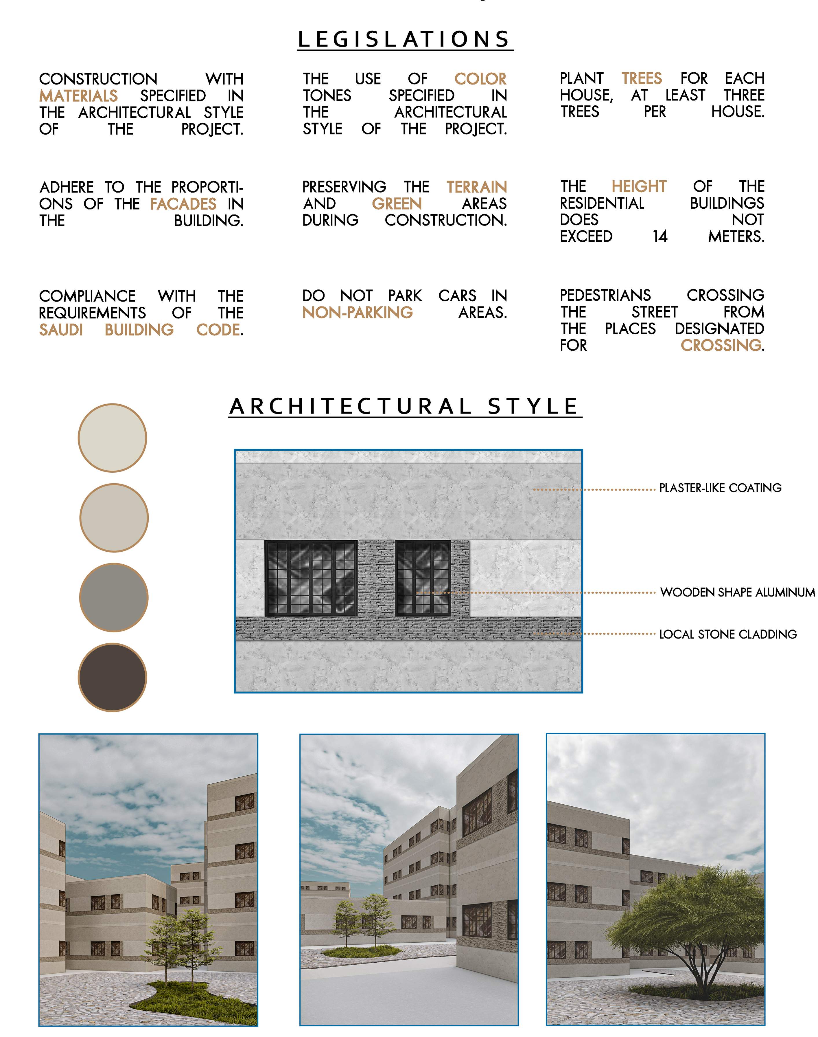
The project establishes a coordinated set of urban and architectural guidelines for central Muhayil.
The guidelines regulate building height, façade proportions, materials, colour tones, tree planting, parking and pedestrian crossings while preserving the existing terrain and green areas. A restrained palette of plaster-like finishes, local stone cladding and wood-effect aluminium creates a consistent architectural character across the proposed development.
Souq Al-Sabt Public Realm
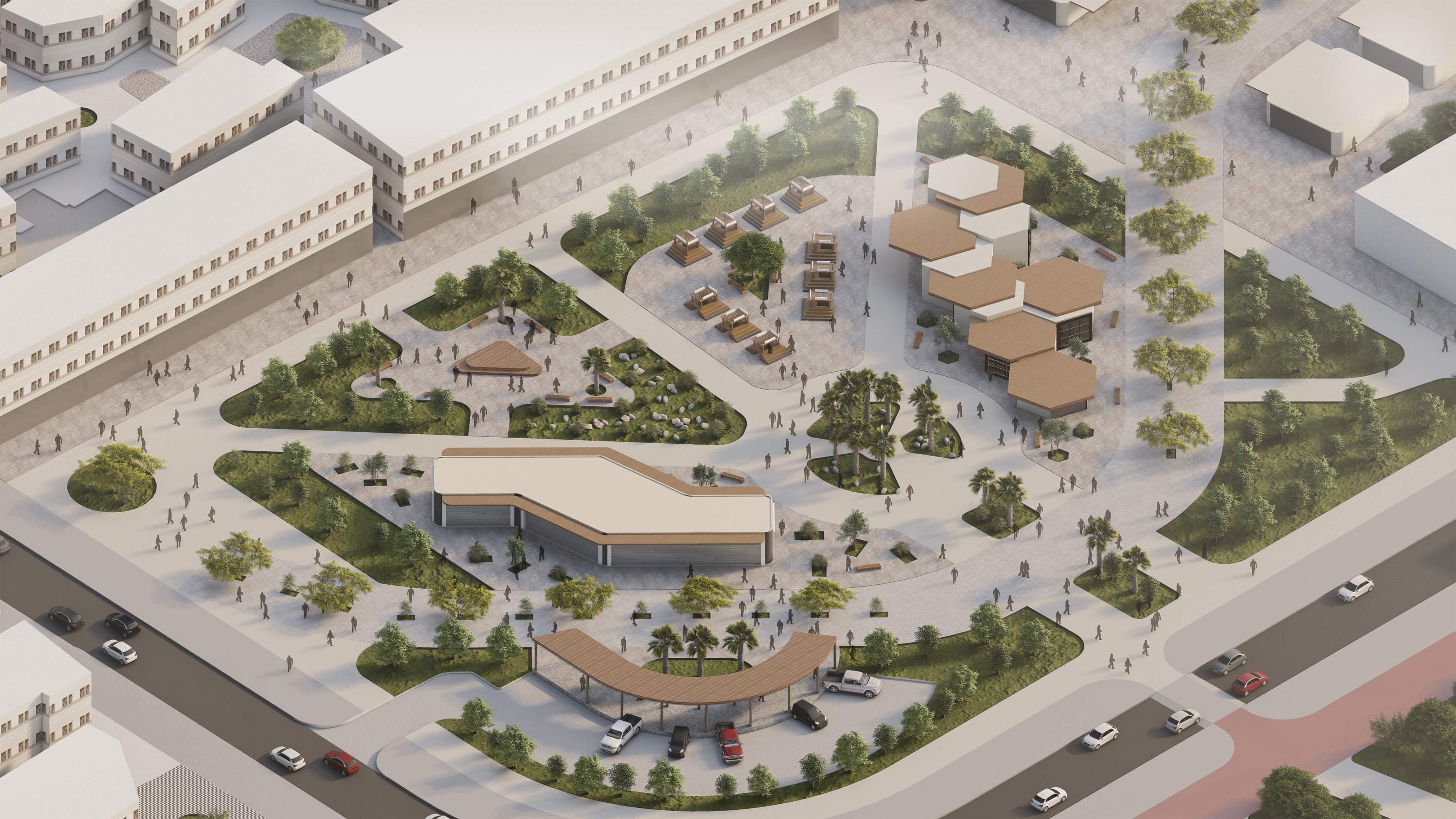
The proposal reorganises the public realm around Souq Al-Sabt through landscaped pedestrian spaces, shaded seating areas and small activity pavilions.
The intervention strengthens the relationship between the market buildings, surrounding streets and open spaces while creating a more accessible setting for movement, gathering and everyday commercial activity.
Urban Massing & Context Model
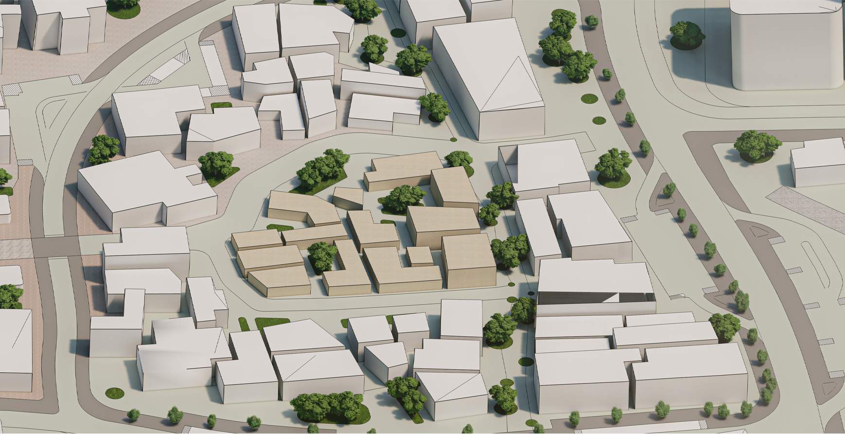
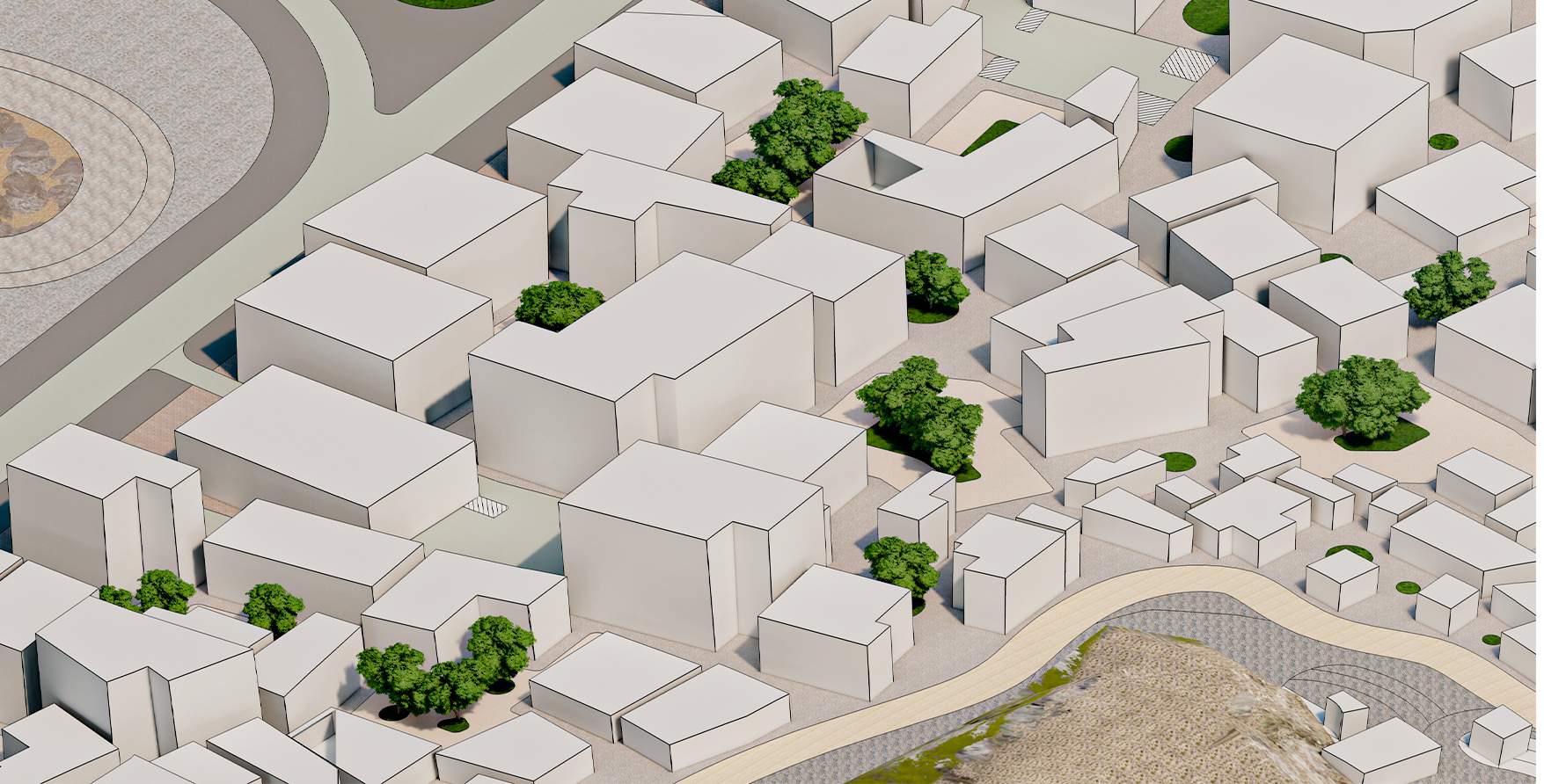
The massing model shows how the proposal is inserted within the existing urban fabric of Souq Al-Sabt. It explains the relationship between the new intervention, surrounding blocks, movement corridors, and open spaces.
It also highlights the response of the proposal to topography, street edges, and the scale of the neighbouring context.